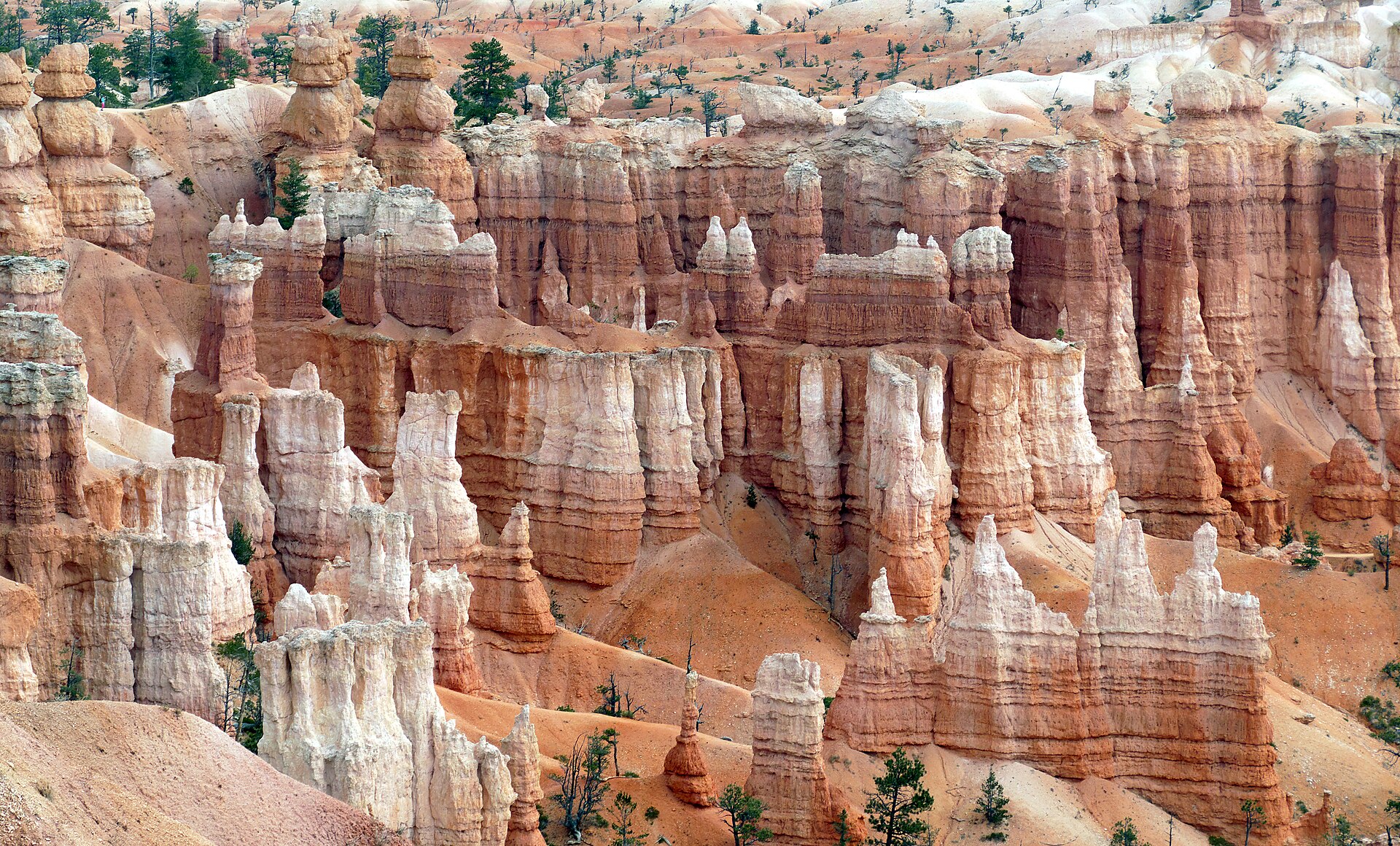

Bryce Canyon is not really a canyon. It is the eroded eastern edge of the Paunsaugunt Plateau in southern Utah, a series of natural amphitheaters where frost and rain have carved soft limestone into thousands of spires called hoodoos. The rim overlooks are what the tour buses come for. The hoodoos are best met at dawn, from below, on foot.
The shape of the place
The park runs along a ridge at eight to nine thousand feet, with the main amphitheater at the north end and a scenic road that continues south past a dozen overlooks to Rainbow Point. Four viewpoints cluster around Bryce Amphitheater: Sunrise Point, Sunset Point, Inspiration Point and Bryce Point. They are connected by a paved rim trail, and every below-the-rim hike in the amphitheater starts from one of them.
Hoodoos form where the limestone of the Claron Formation is fractured and where winter nights freeze water in the cracks. The plateau gets around two hundred freeze-thaw cycles a year, which is why Bryce has more hoodoos than anywhere else on Earth and why the shapes keep changing. The walls of the Navajo Loop lose rock regularly, and the park closes sections after big falls.
The dawn loop
The classic first hike is the combination of the Queen’s Garden Trail and the Navajo Loop, just under three miles with about six hundred feet of descent and climb. Start from Sunrise Point and take Queen’s Garden down: it is the gentler grade, and it delivers you into the hoodoos as the first light comes over the Table Cliff Plateau to the east and lights the spires from the side. Follow the connector trail to the bottom of the Navajo Loop and climb out either through Wall Street, a narrow slot with steep switchbacks and a pair of tall Douglas firs growing in its floor, or the Two Bridges side, which is more open. You emerge at Sunset Point and walk half a mile back along the rim.
Doing it in this direction matters. Coming down Wall Street and up Queen’s Garden works, but the switchbacks are much harder on knees descending, and the light is better arriving from the east. Wall Street is closed in winter and after rockfall; the park posts the status at the trailheads.
Give yourself two to three hours. The distance is short, but every turn asks you to stop, and the climb out at this altitude, with a night of poor sleep behind you, is slower than it looks on the map.
Going further below the rim
- Peekaboo Loop: about five and a half miles from Bryce Point, with more up and down than the numbers suggest and the best window formations in the park. Horse parties share the trail in season; step to the uphill side and let them pass.
- Fairyland Loop: eight miles from Fairyland Point or Sunrise Point, quieter, with long stretches where you will meet no one. Tower Bridge and the China Wall are the landmarks.
- Under-the-Rim Trail: twenty-three miles from Bryce Point to Rainbow Point, the park’s backpacking route, with designated campsites and a permit from the visitor center. Water is scarce and unreliable; plan to carry most of it.
The Figure 8 combination, which strings together Queen’s Garden, Peekaboo and Navajo, is a satisfying six-and-a-half-mile day for fit hikers who want the whole amphitheater in one go.
Altitude, weather and water
Everything at Bryce happens above eight thousand feet. Visitors arriving from sea level feel it as breathlessness on the climb out and a headache by evening. Drink more than you want to, keep the first day short, and take the ascent slowly. There is no water on the trails; fill up at the visitor center or the lodge before you go down.
Summer afternoons bring monsoon thunderstorms from July into September, and the rim is exposed. Lightning has killed people at Bryce. If you hear thunder, get below the rim edge or into a vehicle, and do not shelter under the tallest tree. Mornings are reliably clear, which is one more argument for dawn.
Winter is the secret season. Snow on red hoodoos under a blue sky is as good as the Southwest gets, and the park is nearly empty. Bring microspikes for the Navajo Loop, which turns to packed ice, and expect single-digit mornings. Spring brings mud and closures; late September and October offer cool days, aspens turning gold on the plateau and the first light frosts.
A night on the plateau
The park has two campgrounds, North and Sunset, within walking distance of the rim, with fees per night in the range of what you would pay for a couple of coffees and a sandwich. North stays open year-round with a loop that is first-come; Sunset takes reservations in summer. Check the park website for the current split. Private campgrounds and motels line the highway just outside the entrance, with prices that rise steeply in July.
Camping here is cold. Even in midsummer the temperature drops into the forties at night, and shoulder seasons regularly freeze. Bring a proper bag and a hat to sleep in. The reward is the sky: Bryce is a designated dark sky park, the air is thin and dry, and the Milky Way stands up over the amphitheater like a wall. The park runs astronomy programs in season, and the rim trail between Sunrise and Sunset points is an easy walk with a headlamp. Turn it off when you get there.
In the morning, coffee on the rim while the hoodoos catch fire, and then down.
Common mistakes
- Hiking the loop backwards: up Queen’s Garden is fine, but down Wall Street in the shade with cold legs is a slog.
- Underestimating the climb: six hundred feet at eight thousand feet is not six hundred feet at home.
- No layers at dawn: the rim at sunrise can be twenty degrees colder than the valley you drove up from.
- Sitting on the edge: the rim is friable limestone. Several fatal falls have started with a photograph.
- Shooting at noon: flat light, no shadows, and a lot of other people in the frame.
Worth getting up for
Most people see Bryce from the rim in the middle of the day, and it is still beautiful. Walk into it at first light, with the spires glowing above you and the plateau silent, and you will understand why some of us keep coming back to a place that is not a canyon at all.
