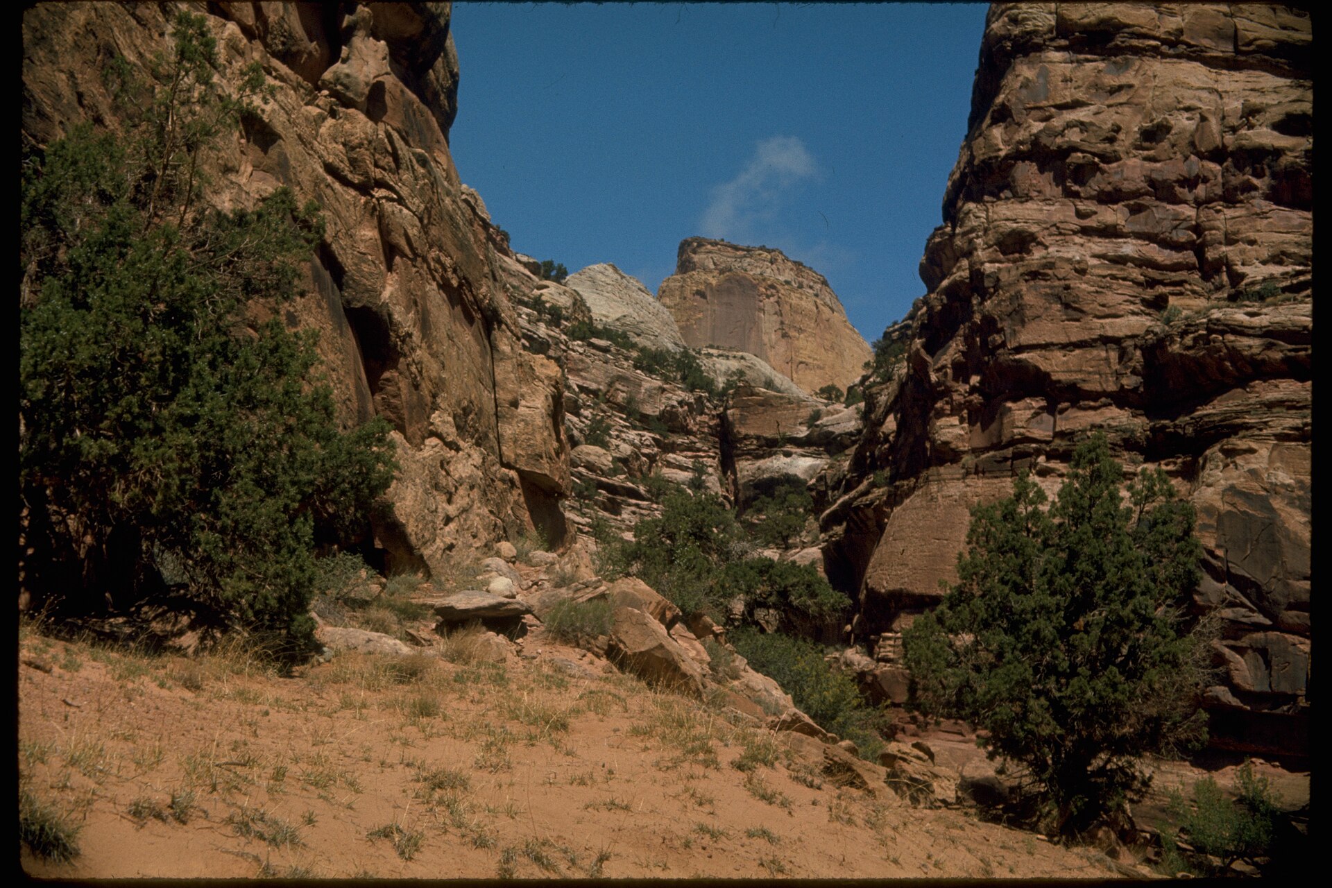

Capitol Reef is the Utah park people drive through on Highway 24 on their way to somewhere louder. The ones who stop find a green strip of river bottom pressed against a hundred-mile wall of tilted rock, a campground shaded by cottonwoods, and orchards where you can pick fruit off the tree in the middle of a desert. It is also a park of washes, and washes are where the real hiking is.
Fruita: the orchards and the campground
The Fremont River cuts through the Waterpocket Fold at Fruita, and Mormon settlers in the 1880s planted what the water allowed: apples, pears, peaches, apricots and cherries. The park now keeps close to two thousand trees in a string of historic orchards along the river and Sulphur Creek. When a block is open for picking, a sign says so at the gate, and you weigh your fruit on a scale and pay a small amount at the honor station. Anything you eat while standing in the orchard is free.
The season runs roughly like this: cherries in June, apricots from late June into July, peaches and pears in August and early September, apples from September into October. Dates shift with the spring weather, so check the park website before you plan a trip around a particular fruit.
Fruita Campground sits right in the middle of it, seventy-one sites on grass under big cottonwoods, with flush toilets and water but no showers or hookups. It is reservable in the busy months and sells out on spring and fall weekends well ahead; check the park website for the reservation window. At about 5,400 feet the nights are cool even in July, and mule deer walk between the tents at dusk as if you were not there.
If the campground is full, there are two small primitive campgrounds in the park’s remote districts, dispersed camping on BLM and Forest Service land outside the boundary, and motels and private campgrounds in Torrey, ten miles west. Motel rooms in Torrey run roughly 100 to 250 dollars a night in high season, less in the shoulders.
Reading the Waterpocket Fold
The park exists because of a monocline, a step in the earth’s crust where the rock layers were bent upward on one side. The Fold runs nearly a hundred miles north to south and stands as a barrier of cliffs and domes that early travelers called a reef. Water draining off the high side has sawed narrow canyons straight through it, and those are the washes you hike. Because they cut across the strata rather than along them, a single walk takes you through several formations: red Moenkopi and chocolate Chinle at the bottom, the sheer Wingate walls, the slickrock Navajo domes on top.
The washes along the Scenic Drive
The paved Scenic Drive runs eight miles south from the visitor center, and two dirt spurs lead into the best easy canyons in the park.
- Grand Wash: A flat walk of about two and a quarter miles one way between walls that close to sixteen feet apart in the Narrows and rise several hundred feet overhead. Walk in until the walls open and turn around, or set up a car shuttle from Highway 24. No shade in the middle of the day; go early or late.
- Capitol Gorge: This was the main road through the Fold until 1962, and the walls still carry the Pioneer Register, names scratched into the sandstone by travelers in the 1870s and after. A mile in, a side trail climbs to the Tanks, natural potholes that hold water after storms. About two miles round trip to the Tanks.
- Cassidy Arch: From the Grand Wash spur, a steep three and a half mile round trip climbs onto the slickrock and ends above an arch you can walk across. Good footing needed; not a place for a sudden thunderstorm.
- Cohab Canyon: Starts across the road from the campground and climbs into a hidden canyon of honeycombed rock, with short side slots worth poking into. Around three and a half miles round trip to the Highway 24 side.
Sulphur Creek and the longer routes
Sulphur Creek is not a trail but a route. From a pullout on Highway 24 near Chimney Rock you drop into the creek and follow it about six miles downstream to the visitor center, wading much of the way and climbing down three small waterfalls. In warm weather it is the most fun in the park; after rain it is a bad idea. Ask at the visitor center about flow and the state of the waterfalls before you commit, and bring shoes that can be wet all day.
Further out, the Cathedral Valley loop in the north district is a rough sixty-mile dirt road that fords the Fremont River and passes the Temples of the Sun and Moon, freestanding monoliths on a desert floor. A high-clearance vehicle is required, and the ford can be impassable after rain. The southern Waterpocket District along the Notom-Bullfrog Road has long slot canyons like Burro Wash and Cottonwood Wash that see a fraction of the visitors and demand more from you: route-finding, scrambling, and sometimes swimming through cold pools.
Water, heat and weather
There is drinking water at the visitor center and the campground and almost nowhere else. The washes are dry except after storms. Carry three liters per person for a half-day walk in summer and more if you are heading into the Waterpocket District. Summer highs in Fruita reach the mid-nineties, which is milder than the low deserts but plenty for a walk between walls that hold the heat like an oven.
The monsoon runs from July into September. Afternoon thunderstorms build over the high country to the west and dump rain that can send a flood down Grand Wash or Capitol Gorge while the sky over the canyon is still blue. Rangers close the dirt spurs when storms threaten; if the road is gated, that is your answer. In a wash, keep an eye on the sky upstream and know where you would climb if the sound of water arrived.
Spring and fall are the seasons. April and May bring wildflowers and orchard blossoms; late September and October bring apples, warm days, cold nights and the cottonwoods going yellow along the river. Winter is quiet and cold, with snow on the domes and the campground first-come.
Permits and small print
Day hiking needs no permit. Backcountry camping requires a free permit from the visitor center, and the rules on where you can camp change with the district; check the park website before you go. Dogs are not allowed on trails. Cell coverage is thin in Fruita and gone in the washes.
Why it stays with you
Capitol Reef does not overwhelm the way the bigger parks do. It works on you slowly: the smell of ripe apricots on a hot afternoon, the temperature dropping ten degrees when you step into the Narrows, the deer in the campground at dusk. Give it three nights, hike a wash every morning, and pick fruit in the afternoon. You will leave planning to come back for a different harvest.
