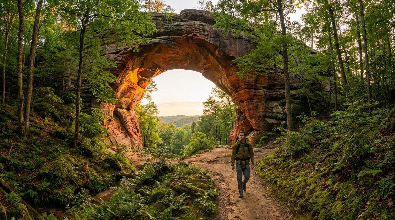

Key takeaway: Successfully navigating Red River Gorge requires combining iconic hikes like the 78-foot Natural Bridge with essential logistics, including purchasing overnight permits at Slade gas stations. Hikers must prioritize safety by downloading offline GPS maps for unmarked trails like Indian Staircase and wearing aggressive tread boots to handle humid, slick sandstone terrain across over 100 natural arches.
The Red River Gorge contains more than 100 natural sandstone arches scattered across the Daniel Boone National Forest. But with so many unmarked social trails and specific permit requirements, how do you navigate this humid Kentucky wilderness without getting lost or fined?
We break down the essential gear, top-rated camping spots, and safety protocols for tracking down iconic landmarks like Natural Bridge and Gray’s Arch. We will help you plan a seamless backcountry adventure through these ancient geological corridors.
- Hiking Red River Gorge for Iconic Sandstone Arches
- 3 Logistics and Gear Must-Haves for the Gorge
- How to Safely Explore Unmarked Trails?
- Top-Tier Basecamps and Local Eateries for Hikers
Hiking Red River Gorge for Iconic Sandstone Arches
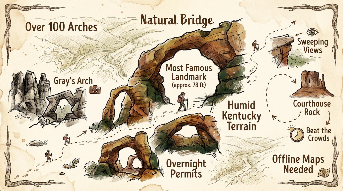
Red River Gorge features over 100 natural sandstone arches, including the 78-foot Natural Bridge. Hikers must navigate humid Kentucky terrain using sturdy boots, offline maps for unmarked trails, and overnight permits from local Slade gas stations.
The geological scale of these formations is massive, but one specific trek stands out as the ultimate introduction to the area.
Natural Bridge and Laurel Ridge Trail
Hiking Red River Gorge: Trails, Arches and Camp Spots to Know starts with the Natural Bridge. This 78-foot sandstone span is the state’s most famous geological landmark. Standing beneath it, the physical scale feels truly immense.
The Original Trail offers a simple, easy walk for most visitors. In contrast, the Battleship Rock path demands effort, featuring steep, rugged stairs that test your legs.
Laurel Ridge provides a stunning perspective of the forest canopy. From these heights, you look back at the bridge, seeing how it dominates the lush Kentucky wilderness.
Beat the crowds by arriving at sunrise. Early starts ensure you enjoy the silence before the midday rush arrives.
Gray’s Arch Loop and Forested Paths
Leaving the ridges involves a steep descent into the deep, shaded forest. You leave the exposed cliffs for the valley floor. The temperature drops instantly, offering a cool, damp relief.
Gray’s Arch is a massive 79-foot span surrounded by jagged rock formations. Its sheer size makes it a favorite for photographers. The light hitting the sandstone creates deep, dramatic shadows.
Weekends here get congested, and parking at the trailhead is very limited. I suggest visiting mid-week or starting at dawn. If the main lot is full, try the Pinch ’em Tight area.
Auxier Ridge and Courthouse Rock
Auxier Ridge feels like high-altitude hiking thanks to sweeping 360-degree views. The narrow path follows the cliff’s spine. You feel totally exposed to the elements while looking across the vast gorge.
The loop connects you to the imposing monolith of Courthouse Rock. This massive stone structure dominates the horizon before the trail descends back into the woods. It is a grim, impressive sight.
This trail tests your endurance. Bring extra water, as the ridge offers no shade or springs.
3 Logistics and Gear Must-Haves for the Gorge
Moving from the heights of the arches to the practicalities of the forest floor, preparation becomes your best tool for a smooth trip.
Parking Permits and Trailhead Access
Day hiking in the forest is free. However, sleeping over requires a specific permit. You must display this pass for vehicles parked between 10 PM and 6 AM per Forest Service regulations.
Buy your pass at local spots like the Slade Shell station. The Gladstone Visitor Center also sells them. A one-day permit costs $5, while three-day stays require a $7 pass.
Trailhead parking is limited. Popular spots like Auxier Ridge often fill by 9 AM. Always have a backup plan ready.
Packing for Sandstone Cliffs and Humid Weather
Wear boots with aggressive tread. The sandstone becomes incredibly slick when wet. Smooth-soled sneakers offer zero grip on these high, dangerous ledges and will likely cause a fall.
Kentucky humidity is brutal. Avoid wearing cotton clothing at all costs. Choose synthetic fabrics or wool blends to keep your skin dry and comfortable during long treks.
Pack your essentials carefully. Bring a physical map and a reliable headlamp. Cell service disappears completely once you enter the deep, shaded hollers.
Best Seasons for Waterfalls and Photography
Spring is prime for chasing waterfalls. Snowmelt and heavy rain fuel the flow of Creation Falls. The entire valley awakens in a lush, vibrant shade of green.
Fall offers the best photography. Vibrant oranges and reds contrast sharply against gray sandstone cliffs. The air is crisp and cool, making long miles feel much easier.
Watch the weather closely. Heavy storms quickly turn these trails into deep mud pits. Check the forecast before entering the canyon.
How to Safely Explore Unmarked Trails?
While the main paths offer safety, the true secrets of the Gorge often lie down unmarked side trails that demand extra caution.
Locating Secluded Arches Without Official Markers
Download offline GPS maps before your trip. Paper maps usually omit social trails found at Red River Gorge. Ensure all data is saved before leaving Slade, as signals vanish quickly.
Track distinct natural landmarks to stay oriented. Watch for unique rock shapes or specific creek crossings along the way. Small stone cairns left by previous hikers can guide your path.
Dense forest canopies make every ridge look identical, increasing the risk of getting lost. Never attempt these secluded paths alone. Always carry a reliable light source for unexpected delays.
Managing Cliff Hazards and Wildlife Encounters
High cliffs present a constant danger here. Sandstone edges are notoriously unstable and crumbly underfoot. Keep children and pets far back from the rim to prevent accidental falls.
Watch for Copperheads blending into fallen leaves. Store all food in bear-resistant containers to avoid attracting Black Bears. Stay calm if you spot a snake. Never approach or harass the local animals.
Assume you will have zero cell signal. Tell a trusted contact your specific route before starting. Hiking Red River Gorge: Trails, Arches and Camp Spots to Know requires proactive communication.
Top-Tier Basecamps and Local Eateries for Hikers
After a long day of navigating ridges and dodging snakes, finding a place to crash and a hot meal is the final step.
Koomer Ridge and Backcountry Camping Rules
Koomer Ridge beats Indian Creek for comfort. It provides toilets and water for a small fee. Indian Creek remains primitive, dusty, and free for those with permits.
Dispersed camping has strict limits. You must stay 300 feet from roads or official trails. Never set up camp under rock shelters or near cliff bases.
State Resort Park options exist too. They provide full hookups and lodge rooms. It is a softer choice for families visiting the area.
Post-Hike Dining and Adventure Hubs
Miguel’s Pizza is the heart of the community. Order the custom toppings and a cold Ale-8-One soda. It is where every hiker eventually ends up.
Try Sky Bridge Station for a different vibe. They serve great hot dogs and local craft beer. The atmosphere is always relaxed and friendly for everyone.
Don’t forget supply runs. Slade markets have ice and firewood. Grab what you need before the sun sets over the cliffs.
Mastering Red River Gorge trails requires sturdy boots, offline maps for unmarked arches, and essential overnight permits. Secure your pass in Slade now to experience Kentucky’s sandstone wonders safely. Your perfect wilderness escape awaits under the forest canopy, start your adventure today for an unforgettable journey through the arches.
FAQ
What are the must-see hiking trails for viewing arches in the Gorge?
For those seeking iconic views, the Natural Bridge and Laurel Ridge Trail is a top choice, offering a 3-mile trek to the area’s most famous 78-foot sandstone formation. Other excellent options for arch-hunting include the 4-mile Gray’s Arch trail and the moderate 5.6-mile loop featuring Double Arch and the Arch of Triumph.
If you prefer shorter walks, Chimney Top Rock and Princess Arch provide stunning scenery with trails under 2 miles. For a more rugged experience, the Auxier Ridge path offers panoramic cliffside views that are hard to beat.
Do I need a permit to go camping or park overnight at Red River Gorge?
While day hiking in the Daniel Boone National Forest is free, you must display a valid permit for any vehicle parked between 10:00 PM and 6:00 AM. These permits are required for both Indian Creek and the general Red River Gorge area, and can be purchased as daily, 3-day, or annual passes at local spots like the Slade gas stations.
For established sites, Koomer Ridge is a popular choice with amenities, while Red River Gorge Adventures offers the only camping located directly within the Gorge. If you choose backcountry camping, remember you must set up at least 300 feet away from roads and official trails, and camping under rock shelters is strictly prohibited.
How can I safely navigate the unmarked or “social” trails?
Exploring unmarked paths like Indian Staircase or Cloud Splitter requires advanced preparation since these routes lack official markers. It is essential to download offline GPS maps via apps like AllTrails before you lose cell service, and carrying a physical map and compass is highly recommended for deep forest navigation.
Always stay alert for natural landmarks and small stone cairns, but never hike these secluded routes alone. The dense canopy can make the terrain look identical, increasing the risk of getting lost, so always inform someone of your specific route before heading out.
What safety precautions should I take regarding cliffs and local wildlife?
The sandstone cliffs in the Gorge can be unstable, so always stay well back from the edges and keep pets on a leash. When it comes to wildlife, be mindful of Black Bears by storing food in bear-resistant containers or locked vehicles. Never leave food in your tent, as this attracts unwanted visitors to your campsite.
You may also encounter Northern Copperheads or Timber Rattlesnakes. To stay safe, watch where you step, avoid placing hands in rocky crevices, and never attempt to handle a snake. If you are bitten, stay calm, keep the limb lowered, and call 911 immediately without using a tourniquet or ice.
When is the best time to visit for waterfalls and photography?
Spring is the prime season for waterfall enthusiasts, as snowmelt and seasonal rains fuel spots like Creation Falls and Nellie’s Falls. This is also when the forest is at its lushest, though you should be prepared for muddy trail conditions and wear sturdy boots with aggressive tread.
For photographers, the autumn months offer a spectacular contrast between the orange foliage and the gray sandstone cliffs. To capture the best light and avoid the crowds at popular spots like Auxier Ridge, aim for sunrise starts or mid-week visits.
